Weather update
Published 5:54 pm Saturday, April 10, 2021
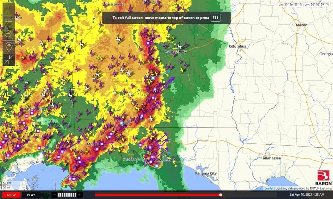
Elliot Jones, Crenshaw County EMS, spoke with the National Weather Service in Mobile this morning. The intense line of storms that Jones monitored throughout Friday and into Saturday has stayed well to the south of our area.
No damage has been reported in Crenshaw County from the storms that made their way through the area overnight.
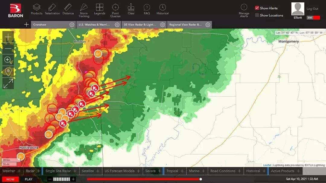
“At one point I clocked wind shear at over 100 mph,” Jones said.
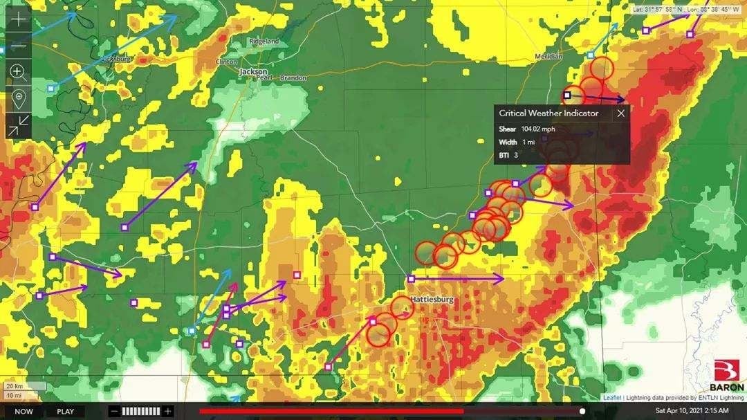
There were multiple tornado signatures on the map during the worst of the storms. Jones said he counted six at one point on radar.
The multiple severe storms overnight produced thunder and lightning strikes across the map. The strong wind gusts did cause some damage and several reports of fallen trees in Monroe and Clark Counties.

The rain should move out by 12 pm today Some isolated showers are possible.